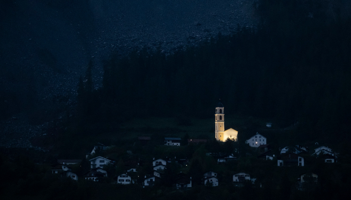
When the mountain came near Brienz/Brinzauls on the night of June 15-16, it was so dark that even the night vision cameras saw nothing. Following the demolition of the island, it has now been investigated exactly what happened. Geologist Reto Thöny reveals the secret and also says why the findings are so important.
Mr. Thöny, your team has reconstructed what happened in the darkness of the night from June 15 to 16. What did you investigate?
It was so dark at night that we couldn't see anything with our cameras. So we wanted to know what we hadn't seen because of the darkness. This is important in order to be able to better assess future events. Until now, we have only had vague clues from historical reports from Igl Rutsch from 1878 about major eruptions from the Berg landslide.
What did you find out?
What we had assumed for the most part. Around 60 percent of the island consisted of hard dolomite. That is why there was a risk of a rock slide. The dark brown foot area of the island, on the other hand, consisted of soft clay slates, which behave differently when broken off than the hard dolomites.
Under the enormous load on the island sliding from above, the foot of the island failed first on the evening of June 15. This led to the clay slate slipping off with a transition into a stream of rubble that could almost reach the schoolhouse.
At around half past twelve, the overlying Dolomites collapsed and they crashed. The fall masses fell with great force on the already deposited stream of rubble made of softer material. The crashing blocks are literally stuck in there.
How did you investigate this?
We reconstructed the processes during observations in the field and from recordings from the monitoring systems. In particular, the rockfall radar, the georadar and the seismic stations helped us with this. The live camera, which Blick TV and the community had set up, also provided a good sound track. Here, for example, you could hear the shock wave from the rockfall.
Geologists roll over a lot of data. But they also go off-road again and again. What did you find there?
The data from the monitoring systems provides extremely valuable information, but we were only able to reconstruct the event after we were on the debris cone ourselves. There we took a close look at which rocks the debris flow and the rockfall consist of. Based on the dolomite blocks, we could easily see in the field how far the rockfall had come and how much the fall blocks had pushed themselves into the soft ground. We also found numerous indications that the debris flow had started as a landslide.
You say upstairs that the island was demolished just as you had expected. Disappointed?
Quite the opposite. Our assessments were largely correct. This shows us that the methods we used led to a realistic result and that a good forecast was therefore possible. With such a complex geological process, this is not a matter of course.
Were there any surprises at all?
Yes, they already existed. We had not expected a stream of debris and a major rock fall that followed immediately. We had assumed that the rock mass of the island would fall down either as a rockfall or as a stream of debris. We had no longer expected a rock slide at the time of the demolition.
Before the evacuation and the event, you had said that it would be dangerous for the village if more than a million cubic meters crashed. Now 1.2 million have left and nothing has happened. Were you too careful?
I don't think so. The 1.2 million consist of around 60 percent dolomite and around 40 percent clay rock. Only half a million cubic meters of dolomite came down as a rockfall. The remaining part was deposited in the middle slope area. The volume of the rockfall from the dolomite was therefore well below one million cubic meters. This is another reason why rockslide dynamics with dangerously high speeds could not develop in the first place.
How do you assess the new risk situation today?
At the moment, it is safe to live in the village if you stick to the perimeter of danger. Nevertheless, we must not take our eyes off the plateau. True, it poses no threat at the moment. But we closely monitor the movements and study the stability of the plateau. Should a new threat develop, we would recognize it early on.
What does it depend on whether the crashed and slipped mass now remains stable?
About the steepness, the material and how it reacts to a lot of moisture. If it rains heavily or for a very long time, a rubble cone can get so wet that at some point it can no longer absorb additional water. Under certain conditions, a mudslide or debris flow can then form.
But we're not afraid that's going to happen here. The heavy rainfall at the end of August was a stress test. As heavy as it was back then, it only rains once every 20 to 30 years on average. However, local flooding of mud and gravel on cultivated land near the cone can still occur during heavy rainfall events.
Can tunnel construction become a problem for stability?
No, I think you can rule that out. Even if there are reductions, this will not affect the stability of the cone. The overall stability of the Brienz landslide has generally improved as a result of the demolition of the island.
Is the village now more endangered or safer than from the flood of debris?
With the departure of the island, the terrain has changed and the risk of falling rocks north of the village has decreased. Our observations, the rockfall radar and the first model calculations show us this. We are now working on revising the hazard map and then we will see whether the restricted danger areas north of the village can be reduced.
If something breaks down again: When can it still become dangerous?
If we should see that the entire plateau or large parts of it are moving more strongly. A million cubic meters is still a value that we are keeping an eye on. Starting at this volume, rockfalls can develop at high speeds. But as I said, we would recognize something like this in good time with the monitoring systems. At the moment, the village is not endangered.
What are you investigating further now?
We are investigating in depth the condition and movement behavior of the plateau and the other areas of the mountain landslide. At the same time, the risk map for fall processes in Brienz is being revised.
We are also investigating the effect of the existing exploratory tunnel on water pressures and slip velocities in the western part of the landslide village. We also want to understand even better what effect this short tunnel has on the entire Brienz landslide so that we can predict even better what the drainage tunnel will do.
And finally, we want to drill two more holes for the drainage tunnel on the planned line.
Interview: Christian Gartmann
Brienz Rutsch bulletin
This interview was published in the Bulletin on the Brienz slide of the municipality of Albula/Alvra dated October 20, 2023. Christian Gartmann has been a member of the Albula/Alvra municipal management staff since 2019 and the representative for communication and media for Brienz slip.