Geologist Thomas Breitenmoser is leading the investigation of the Brienz slide, which threatens the village of Brienz/Brinzauls in the Graubünden community. His tools include huge drills and explosives as searching for tiny traces in water samples and rolling through specialist literature about landslides worldwide.
The municipality of Albula/Alvra provides information on the current situation and ongoing work in a monthly bulletin. Each section is presented in an in-depth interview.
What are your tasks in organizing the Brienz Rutsch community?
We are trying to understand why Brienz Slip is active. If we know more about the slide and its causes, we can assess whether it is possible to slow down the sliding movements through technical measures or even bring them to a standstill.
Put simply, draw a picture of the surface on which Brienz/Brinzauls is standing and sliding. What are the main ways to draw this picture?
In 2018 and 2019, we drilled eight exploratory holes up to 218 m deep in the area around the village of Brienz/Brinzauls. These holes are fine pinholes in a very large area. They show us what the ground looks like and moves there. In order to represent the area between the holes, we carry out geophysical investigations.
With measurements of the propagation of sound waves caused by small explosions and the electrical resistance of the soil, we can primarily record and represent the basis of the landslide over the entire area of the landslide. To learn more about water in landslides, we also monitor sources, analyse water samples in the laboratory and carry out marking tests.
What did you find out?
The village of Brienz/Brinzauls stands on a slippery rock package of up to 150 meters thick, which is currently moving downhill towards Albula at around 1.2 m per year.
This huge, sliding mass consists of broken rock packs or slide floes that move at different speeds. At the bottom of the package, there is a so-called sliding horizon. This is a layer of extremely shredded and broken loose rock several meters thick. It contains a lot of water and is very clayey. Below is the stable mountain range, in which no movement takes place.
They drill, blow up, energize the subsoil and analyse water. Is it normal to examine a slide area so comprehensively?
The amount of effort spent on geological research depends on how important a project is. If you want to understand a landslide and think about repairing it, extensive research is absolutely necessary. The conditions in Brienz/Brinzauls are very complex. One day, the village itself slides and is damaged more and more as a result. In addition, falling processes from the hillside can endanger the village and parts of Vazerol, Surava and Tiefencastel as well as traffic routes, pipelines and the Albula River.
If the Brienz slide were in an area that was not or only sparsely populated and there would be no threat to the population, the investigation would certainly not be as intensive.
Do you now know what it looks like below Brienz/Brinzauls and above in the mountain?
Around the village and down to Albula, we already know exactly how the slippery mass is structured, how powerful it is and at what depth the movements take place.
On the mountain above the village, we still lack this information, and we do not yet know the connection between the two landslides on the mountain and under the village. That is why we are carrying out further geological surveys on the mountain from mid-May until late autumn. Four more exploratory holes are at the heart of the investigations. We are also monitoring the sources in the area and expanding the marking experiment launched in June 2019 to research the underground water flow paths.
Water is repeatedly described as the most important driver of the slide. The locals have a lot of knowledge about this that has been handed down for generations. Do you also listen to this ancient knowledge?
We are very happy to receive any kind of information from the population and incorporate this into our investigations and considerations, even though this may not always be apparent at first glance. In autumn, for example, we specifically drilled a core hole in the Plang Siz area to investigate a water deposit that was suspected there. It has been shown that water is present, but not to the extent that was expected.
In addition, based on information from the population, the Propissi drainage system is being renovated.
Open canals were built in the Propissi area more than 100 years ago. The pipes went into the ground 40 years ago. More than five kilometers of new open canals are now being built again. Why open channels again now?
Open trenches and channels are easier to control and maintain. In an area that is in motion, they react more kindly to sliding movements and are more flexible than stiff pipes in the ground.
If buried pipes break in a landslide, they lose the collected water again. Often you don't even notice that. A faulty drainage system is therefore even worse than none at all. One disadvantage of open ditches and canals, however, is that agriculture loses a certain amount of land. They are also obstacles to roads, paths and management. In the new project, almost 30 smaller and larger crossings will therefore be built across the canals.
What do you expect from the renovation of the Propissi drainage system?
We're following all leads. It certainly does no harm if superficial spring, rain and meltwater is caught and drained outside the landslide so that it cannot flow into the landslide. But you shouldn't expect too much either. According to everything we know so far, surface water is not the main factor behind sliding movements. In the best case, however, a positive effect can be achieved by slowing down the landslide.
Does water come from the depths? Where does it come from?
We suspect that water that circulates deep in the mountain plays a bigger role than water that seeps into the slippery mass from above. The water in the solid rock below the sliding mass is under pressure. It acts like a buoyancy on the sliding mass from below and thus promotes sliding movements.
We cannot yet say exactly where this water comes from. The marking experiment started last summer has not yet yielded any results that give us clues to this topic. Even the data already available from source monitoring and the laboratory results of the water samples do not yet provide any conclusive results. That is why these investigations will be continued and supplemented this year.
High hopes are now placed on a tunnel under the village, which could be used to remove water from the slide. How far are you with this project?
We have compared landslide remediation measures with the Brienz slide worldwide. It has been shown that water often plays a key role. Using several examples, we have seen that drainage stole in solid rock under landslides could be successful. From such a tunnel, you could drill into the landslide from below and thus drain it.
First, we plan an exploratory tunnel under the village. It will be smaller than the later drainage tunnel and should show us whether drainage of the landslide could even work. He will therefore show us whether we are on the right track. Ideally, it will also cause a certain amount of drainage and slow down the sliding movements. In this case, it could also be expanded into a larger drainage tunnel.
Time is short. Why a small cleat first? Wouldn't it be easier to drill the drainage tunnel directly?
Such a tunnel cannot be built easily and without detailed clarification. It's a full-fledged tunnel in which a truck could travel. Before you start such a large construction project, you need very extensive clarifications, as there are many dangers underground.
Geology, tunnel construction in the mountains, the use or disposal of excavation material, the effects on the environment and the environment, and costs are just a few of the subject groups that need serious clarification despite time pressure.
Can you speed it all up?
We're already doing that. Normally, planning the exploratory work would not start until numerous other clarifications have been made. We are now clarifying and planning certain aspects in parallel and thus gain valuable time. There is a risk that you might be wrong and that certain work will be free.
In view of the urgency here, however, this risk is deliberately accepted. If everything goes optimally, I have the hope that we can start building the exploratory tunnel in 2021.
Do you understand when locals and second home owners are impatient and demand quick solutions?
Of course Brienz/Brinzauls is their home, many of them grew up here. This is where their houses and farms are located, in which they have invested a lot of money and passion. You don't want to move away from here. It's beautiful here.
Unfortunately, the geological conditions at Brienz Rutsch are also extremely complex. There are no easy solutions here. We do everything we can to understand the landslide as quickly and thoroughly as possible. Only then can we take measures that promise success. The quickest solution isn't necessarily the best.
You'll usually deal with reservoirs, landfills, tunnels, mines, and other construction projects above and below ground. Is Brienz Slip something special for you?
The Brienz slide is definitely something very special. Professionally, this is an enormously complex project that a geologist will probably only be allowed to supervise once in his professional life. In addition to complexity, there is a high level of urgency: We must quickly gain insights and propose solutions that enable people in the area to live safely in their homes.
They have a huge responsibility. How do you deal with that?
I can rely on an experienced team of geologists. Together, we are working to understand the Brienz slide in order to clarify as quickly as possible whether and how restructuring and thus normalization of the situation is possible or not. We discuss a lot, weigh things up, decide together and thus share responsibility. It's the only way it works.
If we understand the countless interrelationships and combine them to form a larger whole, we will be able to create a basis for successful landslide recovery in the best case scenario. Unfortunately, this is not certain. Our work can also lead to the realisation that the hoped-for renovation will not be possible despite all efforts. Nature tells us what is feasible and what we should not do better.
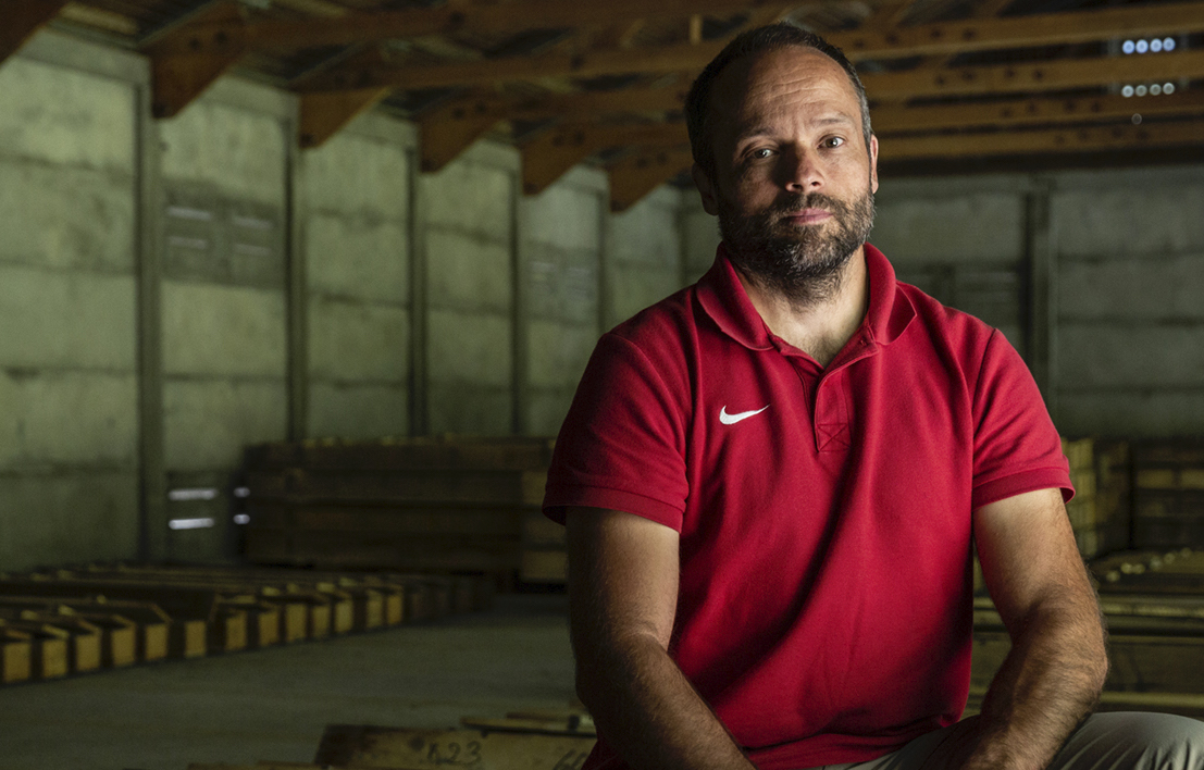
About the person
Thomas Breitenmoser (47) grew up in Herisau and studied geology at ETH Zurich. He heads BTG Büro für Technische Geologie AG in Sargans and Chur and has been working intensively on the Brienz slide since 2018.
As a geologist, he is used to discovering and understanding the most diverse phenomena, processes and changes in nature. He is particularly attracted to the combination of science and practice: In the wild, he carries out investigations and collects samples and data. He then analyses them meticulously, describes his findings and communicates them to experts from other areas, authorities or the affected population.
Interview: Christian Gartmann. Christian Gartmann has been the communications and media officer for the municipality of Albula/Alvra for Brienz Rutsch since 2019.